Monday, September 27, 2010

Potatuck

From Wikipedia, the free encyclopedia

The Potatuck (also Pohtatuck, Pootatuck) were a Native American tribe that existed during and prior to colonial times in western Connecticut, USA. They were a sub-group of the Paugussett Nation and lived in what is present day Newtown, Woodbury and Southbury. They were a farming and fishing culture, cultivating corn, squash, beans and tobacco and fishing in freshwater and possibly traveling to the coast to fish in summer months.[1]

They eventually amalgamated with the Weantinock and other indigenous people to form Schaghticokes in western Connecticut.[citation needed]

 References

 Charles W. Brilvitch (2007). A History of Connecticut's Golden Hill Paugussett Tribe. The History Press. pp. 13--14. ISBN 978-1596292963. http://books.google.com/books?id=KSzS0H0IU4kC&pg=PA13.


This article relating to the Indigenous peoples of North America is a stub. You can help Wikipedia by expanding it. v • d • e
Retrieved from http://en.wikipedia.org/wiki/Potatuck

The Indians of the Housatonic and Naugatuck Valleys - Google Books Result

Samuel Orcutt - 1882 - History - 220 pages
http://books.google.com/books?id=FA8TAAAAYAAJ&lpg=PA106&ots=6Wc0yLBTo6&dq=a%20place%20called%20Potatuck&pg=PA106#v=onepage&q=a%20place%20called%20Potatuck&f=false
This indicates that all the various clans of the Potatuck Indians were one tribe, under one general government, on both sides of the Housatonic, then called under one general government, on both sides of the Housatonic, then called the Potatuck river, to the Massachusetts line; and to this conclusion we are led by the signatures of later deeds, for some of the signers to the Woodbury deeds of 1700, 1705, and 1706, and some of those to a deed of lands north of Woodbury in 1716, are the same men who signed the New Milford deed in 1703.


One of these names underwent several rather amusing changes. We find it in 1705, as Cotsure, in 1716 as Corkscrew, and in 1739, to a New Milford deed, Cocksure, which was not long afterwards changed to Cogswell, under which name some of the lineal descendants are still residing in New Milford.

On the 18th of May, 1700, the inhabitants of the town, having become numerous for those days, made their fourth, or Nonnewaug Purchase. To this time, it seems that the sagamore of that name had retained his possessions in the valley of the Nonnewaug or East Sprain stream. But now it came his turn to make room, and it seems that he and his companions did it with a good grace, as the deed informs us, the sale was made
" For valid considerations moveing thereto, besides y' y* desire y' is w,hin us of a friendly correspondency wlh y* English Inhabitants of s*1 Woodbury."
For these considerations and inducements they granted
" All y' parcell of Land, bee it more or less, by estimation six square miles; And bounded on y* East w* y* stated Boundaries between y* inhabitants of Sl1 Woodbury and Waterbury, Bounded North w" y* Bound granted by y* Genri Court to y* s11 Inhabitants of Woodbury; Bounded West w* Land belonging to Indians as yet not purchased by y* sd English at a Brook well known both by English and Indians, called y* North-Spraine, taking in y* sd Brook, as it runs North and South, so that this o' Deed of sale comp'hends all y* Land bounded West w"1 y* sd North-Spraine, and East w" Waterbury &^ Woodbury Bounds, taking in all ye land on botk sides of ye East Sprain. And bounded South wlb y* Land formerly purchased by y* English Inhabitants of sd Woodbury."

In y behalf of himself and all potatuck Indians confirming this Bill of Sale Exactly recorded from y* originall this 16th day of May 1701 P' John Minor recordr"


Monday, September 13, 2010

The Word “Nonnewaug”

Tim MacSweeney - January 2005


Without a doubt, one of the most often used local Algonquian place-names used every day in Woodbury, Connecticut is the word “Nonnewaug.” Among other things it is a river, a high school and a school district, a road, and more. A section of the town is still called “Minortown,” but it was originally called “Lower Nonnewaug.” The region that includes the Upper and Lower Nonnewaug was originally called “The Nonnewaug Purchase” in 1700 when the “fourth purchase of land was made from the tribe of Indians called Nonnewaug (“Woodbury and the Colonial Homes.” page 18). William Cothren, describing the layout of Main Street in his 1854 History of Ancient Woodbury, refers to “…the Indian trail leading from the Nonnewaug wigwams to Pootatuck village, passing the grave of Pomperaug…(page 38).”


Despite references to the area of land, the Indian place-name’s origin is popularly known as a reference to a Native American person who lived in the years around 1700 who is mentioned in early Woodbury land deeds and was identified on them as “Nunawauk,” “Nunnawake,” and “Nunnawaoke,” accompanied by “his marke,” that Cothren believes to be a snowshoe, but also bears resemblance to an eel trap. By the 1850’s the person referred to became known as the Sachem Nonnewaug.


The word "Sachem" is traced by linguists to the Proto-Algonquian word for leader, "sa:kima:wa" and "all it’s variations are of a linguistic nature, rather than functional (Bragdon 1996)." Robert Grumet uses the word "sakima" in The Lenapes (1988), and translates it to: "Keeper of the Peace" or "Peace Chief." The man known as the Sachem Nonnewaug on those ancient deeds was most likely chosen as "Peace Keeper" by the people who settled with him at a place that was known by them as Nonnewaug, a contraction of a descriptive string of Algonquian words, and not the man’s name at all, but rather his title, sort of like calling someone by the name of the city or the country (the place) where that person was the Mayor or the President.

William Cronan, writing in his 1983 Changes in the Land, says that Indian place-names in New England “related not to possession but to use (page 65).” The Woodbury historian William Cothren had much the same to say in 1872 in his second volume of his History, “Every name described the locality to which it was affixed…sometimes it indicates one of the natural products of the place, or of the animals which resorted to it…a definite meaning, such as seemed called for by the object named, or the circumstances surrounding it…” Cothren goes on to say, “PAUG, POG, BOG, donates water at rest. But in New England in some instances, it is applied to brooks, rivers, and running streams. AMAUG, denotes a fishing place…From these particles, and others, out of which the local names of our territory were constructed, as well as from local tradition, we may, perhaps, translate our Indian appellations as follows: (which eventually includes)… NONNEWAUG, the fresh pond or fresh fishing place …”

A native Connecticut writer with a PhD in linguistics, Carl Masthay writes in New England Indian Place Names, “One salient ending is -peaq or – paug, meaning ‘watery (p) open area (-aug)…Another salient ending is –tuck, “river (with waves), not to be confused with –uck, ‘land’ or -tuck, ‘tree…Thus we have…Nonotuck (MA), ‘in the middle of the river…’ If Nonne is the same as or similar to Nono -and as Cothren says, “AMAUG, denotes a fishing place” could it mean – and describe-“The Fishing Place (or Weir) in the Middle of the Open Area?”


The weir is located on the river at the edge of a floodplain, near what may be the site of the “Nonnewaug wigwams” Cothren refers to, as well as the associated burial grounds that he describes in his History. The descriptive place name, applied to the location of the stone Weir, as well as local history, seem to point out a Native American construction, a fishing place in the middle of an open or cleared area. Cothren writes that “Our fathers… quickly placed the open lands under cultivation, securing good crops the year of their removal… and they quickly overrun all meadow land quite to Nonnewaug Falls.” The early English settlers from Stratford were able to plant because the Native People had already cleared the land. Native People still lived at the floodplain by the Falls, by the weir until the “confirmatory deed of 1706,” possibly to 1734 when the land was divided into “homelotts,” as documented in Cothren’s History.

In The Fair Lawn/Paterson Fish Weir from the Bulletin of the Archaeological Society of New Jersey, Vol. 54, 1999, allen lutins and Anthony P. DeCondo write:

“Riverine fish weirs in eastern North America are generally associated with the exploitation of anadromous and catadromous fish. Anadromous fish are those which migrate upstream from the sea to spawn, and catadromous fish (primarily eels) are those which swim from lakes, rivers and streams out to sea to spawn. Fisher (1983:36) characterizes anadromous fish as constituting "probably the greatest density of available food that existed for pre-agricultural societies in the Hudson Valley." They are a particularly attractive resource because spawning runs occur within a highly predictable time frame. These runs can usually be predicted to within a few days' accuracy (http://www.lutins.org/weir/index.html).”
     See also: Prehistoric Fishweirs in Eastern North America - Master's Thesis by allen lutins 
 http://www.lutins.org/thesis/

Weirs have been documented on the Housatonic River that the Nonnewaug River eventually flows into. In 1947, Claude C. Coffin wrote about stake weirs that were found at the mouth of the river as well as stone weirs farther inland. He writes:

"(The) mode of construction changed beyond the mouth of the river. At the mouth of the river, the Indians drove the stakes into clay or shell bottom, which held them firmly in place. But up the river, where the current was much stronger and swifter, and the bottom was loose with sand and rocks, the stakes would not stand up for long, for the current washed them out. To overcome this difficulty, the Indians built stone walls out from shore, extending down into the river for almost thirty to forty feet. The walls were built at an angle of about seventy five degrees and heading upstream (Figure 10). Some of the stones were quite large, and it would require two men to handle them. After these walls were built, the stakes were driven between the rocks and in that way the river could not undermine them. At this late date, the stakes have all disappeared. However the walls are still there and can be found at very low tide or when the river is very low in the summer month. I have found two such walls, one at Wheeler’s Farms, in the northwestern part of Milford township, another across the river in Shelton Township, north of the mouth of the Far Mill River. I found still another at Otter Rock in Oxford township below the Stevenson power dam. A friend, Mr. Clyde Batchelor, has informed me that he has seen several walls at Still River in New Milford. That was a famous ground for fishing shad in the early days. There is no doubt that, in the early times, these fish weirs were numerous for miles along the river, as far as the shad and other fish went to their spawning grounds. But today they have all about disappeared. Some of course are buried under mud and sand; others have been destroyed by dredging; while others are under flooded areas where power dams have been installed. Extinct also are the fish that once went up the river by the tens of thousands."


Conclusion

The Algonquian place name, it’s proximity to a historically documented village, the Nonnewaug wigwams, and the great distance between it and the earliest mill suggests that the row of boulders is possibly a native-built construction similar to others across the nation. Some of these stone weirs have been added to the National Historic Register, such as the Indian Fish Weir (Also known as Indian Dam, Indian Fish Trap or Site #13IW100) in Iowa. Natural processes are eroding the weir; few weirs have been studied despite their widespread use. A study of the Nonnewaug Weir could add much understanding to the archaeological record.


References Cited

Bragdon, Kathleen J.

1999 “Native People of Southern New England.” University of Oklahoma Press

Coffin, Claude C.

1947 “Ancient Fish Weirs Along the Housatonic.” Bulletin 21 of the Archeological Society of Connecticut

Cothren, William

1854 “History of Ancient Woodbury Volume I.” Waterbury CT

1872 “History of Ancient Woodbury Volume II.” Woodbury CT

Cronan, William

1983 “Changes in the Land; Indians, Colonists, and the Ecology of New England”

N.Y.: Hill and Wang.

Lutins, Allen and Anthony P. DeCondo

Jan. 25, 2005 The Fair Lawn/Paterson Fish Weir.

http://www.lutins.org/weir/index.html

Masthay, Carl

1987 New England Indian Place Names in Rooted like the Ash Trees Richard C.

Carlson, ed. 13-17 Naugatuck CT : Eagle Wing Press.


Strong, Julia Minor, ed.

1931 "Woodbury and the Colonial Homes." Woodbury, Conn.: Woodbury

Woman's Club.

Friday, August 6, 2010

Tree of Peace and Treaty Trees

These are the very large Oak Trees that mark where Nonnewaug Falls is. Turn right onto the side trail that leads into a grove of hemlocks when you reach them, but consider for a moment just how old those trees might be.

And consider this:

I know you’ve heard of “Bury the Hatchet,” but did you know the rest of the expression?


A piece of Haudenosaunee Oral history: "Peacemaker uprooted a White Pine, exposing a deep cavern with a river at its bottom. He told warriors to cast weapons into this hole and the river carried the tools of war deep in the Earth.
Replanting the White Pine, The Peacemaker said, "To bury the hatchet signifies the end of war, killing and violence."
 
In other words,  “Bury the Hatchet and Plant the Tree of Peace."
 
So could these trees be 300 years old? Would Sachem Nonnewaug have buried a hatchet and then have planted one of these trees when he signed the document to the left? A second treaty was made ten years later. Is the smaller tree related to that?


Tuesday, August 3, 2010

Nonnawauk #9

Sec. 1. "No person shall be entitled to adoption into the Order except a free white male of good moral character and standing, of the full age of twenty-one great suns, who believes in the existence of a Great Spirit, the Creator and Preserver of the Universe, and is possessed of some known reputable means of support (which means the Sachem Nonnewaug wouldn't be allowed to join)."


Monday, July 12, 2010

A Chief's Waterfall Beckons On A Hot Day

By PETER MARTEKA, pmarteka@courant.com
10:26 a.m. EDT, July 11, 2010


When it is fry-an-egg-on-the-sidewalk hot, there is no word in the natural world better than waterfall.

The word brings up images of a shaded dell with huge hemlocks growing around a small stream twisting through the forest before meeting an rocky overhang and then plunging to the earth as a cool, misty spray wafts through the sunlight breaking through the forest canopy.

Ironically, that describes Woodbury's Nonnewaug Falls. And like anything magical, you must take a little journey to reach your reward. From a parking area off Hickory Lane, visitors pass farm fields and cross the Nonnewaug River. Then it's a steep climb through a deciduous forest, under transmission lines and past more farm fields until the entrance to the falls – like a dark tunnel – stands before you.

And generations of people – from Native American Indians to visitors arriving on horses and buggies - have visited these picturesque falls. A trail through the hemlocks takes visitors along the northern slope of the upper and lower falls – now protected by the town and Bethlehem Land Trust. At different points visitors can get a closer look at the falls. For those who don't mind getting their feet wet, a trip along the stream's mossy banks will reward them with the spray from the falls as it plunges into huge, deep pools.

The falls are named after one of the last chiefs of the Nonnewaug tribe who was buried nearby. A plaque on the southern side of the upper falls keeps the chief's memory alive. The plaque was placed there in 1916 by members of the Nonnewaug tribe of Seymour. It reads: "To the memory of Nonnewaug last chief of his tribe, friend of his white neighbors, who sleeps with his fathers near these falls which bear his name."

The falls are fed by a clear, gentle stream – the East Nonnewaug River - that cut channels into the rocky ledges. Moss covers the rock outcroppings, the gnarled and twisted roots of the hemlocks and the boulders in the stream. It's always fun to walk upstream and view this tranquil, gently flowing waterway that turns into a huge cascade below.

"Viewed as a whole," wrote William Cothren in his "History of Anciety Woodbury," published in 1854, "it is as wild and romantic a place as can anywhere be found in our country." Especially when eggs are frying on the sidewalk.


Take I-84 to exit 17 to Route 63 north. Take Route 6 west and then Route 61 north. Take Nonnewaug Road and follow to Hickory Lane. The trail head is straight ahead at the end of a dirt road blocked by an iron gate. Follow the trail and look for the path on the far right at the fork.

http://www.courant.com/news/connecticut/hc-marteka-nonnewaug-falls-0711-20100711,0,3431858.story

Saturday, July 10, 2010

A YouTube Video:


**ICE-UP THE BUBBLY** Nonnewaug Falls Dec. 30, 2009 PALINSMITH

The Pool at the Upper Nonnewaug Falls


You must teach your children that the ground beneath their feet is the ashes of your grandfathers. So that they will respect the land, tell your children that the earth is rich with the lives of our kin. Teach your children what we have taught our children, that the earth is our mother. Whatever befalls the earth befalls the sons of the earth. If men spit upon the ground, they spit upon themselves. ~Native American Wisdom
I would feel more optimistic about a bright future for man if he spent less time proving that he can outwit Nature and more time tasting her sweetness and respecting her seniority. ~Elwyn Brooks White, Essays of E.B. White, 1977

We cannot command Nature except by obeying her. ~Francis Bacon

Let us a little permit Nature to take her own way; she better understands her own affairs than we. ~Michel de Montaigne, translated

Sunday, July 4, 2010

The Literal Meanings of the word "Nonnewaug"

Nonnewaug is a Native American Place-Name. Those Indian names are like "tiny imagist poems," according to a certain expert in the field, and literally describe the place from a point of view of the Native People living in the area around 1659, in the case of Nonnewaug. Could be a physical description or related to a historic or ancient event - or almost anything else that was important to them. The "w'aug" part means a fresh water fishing place. Often these are fish weirs, like Boyleston Sreet in Boston and made of wooden stakes, or sometimes they are made of stones like the Fairlawn in Paterson NJ. The "Nonne" part I think implies "in the middle," judging from other Algonquian place names.

Above photo: Nonnewaug Fish Weir June 1997.


In the middle of the river - or in the middle of ancient corn fields - or in the middle of the valley that once was a glacial lake with two ancient rockshelters on opposite shores- are all possibilities of what middle the Indians were thinking about. There is a line of stones across the river, four foot long and two foot wide boulders that probably is the stone fish weir that gives the name to the area of land - and the river, the high school, and our street address. The Sachem Nonnewaug, or the "Keeper of the Peace at the Fresh water fishing place in the middle," got attached to this name because the English thought it was his name rather than his title - as if his name was "mayor" or "burgermiester," and so now people attach the word to the man rather than this slowly dissappearing ancient Indian structure.

My blog  Waking Up On Turtle Island has some photos (all right, alot of photos) of the weir - which really should be on the National Historic Register rather than being totally ignored by the archeologists I've contacted about doing so, starting back in the summer of 1997 when "I Woke Up" about the Nonnewaug Fish Weir.

 Some Blog Posts: 
Correspondence from the author of a book where I'm a footnote
  http://wakinguponturtleisland.blogspot.com/2009/10/nonnewaug-fish-weir-10152009.html
 A Video
fishweir blues
A Long One with all kinds of photos.

Saturday, July 3, 2010

The Legends of Nonnewaug Falls

A couple years ago, I wrote something about "The Legend of Nonnewaug Falls" according to William Cothren in the History of Ancient Woodbury:

The same legend appears, in three different versions, about 50 years later in "The Town and People: a chronological compilation of contributed writings from present and past residents of the town of Woodbury, Connecticut" by Julia Minor Strong:
MAY 23, 1878.—Nonnewaug Falls. How many there are who travel in foreign lands to view the beautiful objects in nature and art, who know not that at home they can find natural scenery often superior to that which they have spent both time and money to see. Woodbury is full of beautiful views and rugged scenery, the joy of the artist's soul. Few there are who can or will appreciate that which costs them nothing but time to enjoy. Would you like to see beauty unadorned by naught save nature's gifts, go to the Falls of the Nonnewaug on through the meadows, through field and valley, till you come to the ravine down which pour the waters from the Falls. Follow the stream if you would enjoy the whole of the beautiful prospect as it spreads out before you: 'tis a rugged path, but when the object is gained you are well repaid for toil and trouble. Take your seat on the mossy bank beneath the Falls, overshadowed by birch and hemlock, and you can well spend a few hours in looking at the silvery waters as they dash over the falls and rise in a misty veil around you. Imagination carries you back to the time when the red man alone looked on the waters and the hand of man had not changed the works of his Maker. In the mirror of times long passed away, you can see again the dusky forms of warrior braves as they stood in your place and worshipped the Great Spirit who presided over the Falls and their race.


The last medicine man of his tribe lived at the Fall of the Misty Waters. He alone of his people had the power to call up the spirits of his forefathers from the misty deep and learn of them the future of his race. Here he lived with his dusky sons and dark browed daughters where the mist from the Falls rose like incense over the sacred altar. Secure from the gaze of man he carried on his incantations and called on the great Manitou to bless and protect his people or to curse the enemies of his race. It is related that, enraged because his kindred had parted with some of their lands to the Pale Face, he cursed them in his wrath. "The plough of the Pale Face shall go over the bones of Pomperaug and his kindred, the corn shall wave over your hunting grounds, your blood shall mingle with the foe, hoe his corn and till his ground.'' A prophecy fulfilled today.

WOODBURY, CONN. W. A. STRONG.

Same book, same legend:
DECEMBER 4, 1897.—All classes and conditions of people have their traditions and legends. Look where you will, all countries and races from the remotest time, and now, in our own town we have our traditions. Is it not so? We have them, say what you will, and they are so interwoven with our lives that it is difficult to separate truth from the legends.

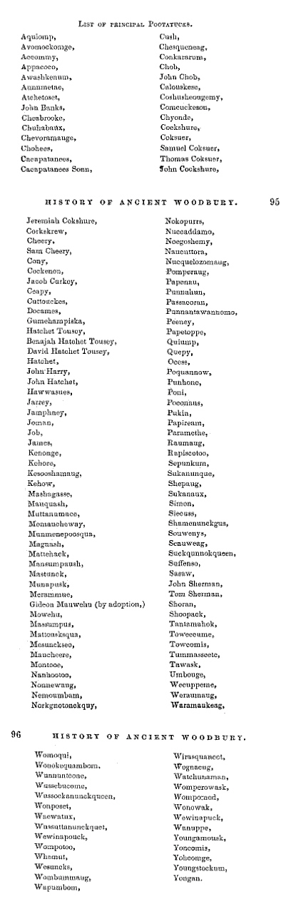
Roving tribes, of a copper-colored race, were found here by the first explorers, and it is not known how the country was peopled. The different tribes were called by various names, but almost all belonged to two great families, the Algonquin and Iroquois. Most of the tribes were divided into clans, each having a chief or sachem, without written laws, but ruled by customs and traditions.

Many of the tribes, of the North American Indians, relate in legend that the human race was destroyed by a deluge, and the gods, to repeople the earth, changed animals into men. A traveler tells us this tradition. Formerly, the father of the Indian tribes lived toward the rising sun. Being warned in a dream that a deluge was coming to destroy the earth, he constructed a raft, on which he saved himself and all animals. He floated many months, and the animals, which then had the power of speech, complained against him. At last a new earth appeared, when he stepped down on it with all those creatures, who from that time, lost their power of speech as a punishment for murmuring against him. The Seneca Indians have a superstition, that, when a young maiden dies, they imprison a young bird before it tries its powers of song, then, loading it with caresses, they let it loose over her grave, believing that the bird will not close its eyes or fold its wings, till it has flown to the spirit land and delivered its message. In some localities the crow was regarded as a sacred bird. The Indians had a tradition that the crow brought their first corn to them from Kiehtan, who lived in the Southwest. Their belief in the Great Spirit, and many allusions to it, are most touching and beautiful; also those referring to the stars, winds, birds and flowers so charmingly interwoven in the song of Hiawatha. Every place visited by them received a name, topographical or historical, preserving the memory of a great Sachem, a battle, or a feast. Then again, it indicated some natural product of the place, or the animals which resorted thither. We have many such names in our vicinity. How many mountains and other localities derived their name from some legend? It is said, that the Indians living near the White Mountains in New Hampshire never ascended them, believing the gods resided there, shown in the clouds, winds and other manifestations. They supposed that the invisible inhabitants would resent any intrusion into their sacred precincts. We are so familiar with the tradition connected with Bethel Rock it seems unnecessary to repeat it.

The ancient Sagamore Womoqui, whose lodge and wigwams of warriors were near the Nonnewaug Falls, was .deeply saddened at the thought of parting with his hunting grounds and lands, where his people had roamed in freedom long before the paleface appeared in these regions. He could see the western march of the nations, his people becoming forgetful of his counsels, fewer in numbers, the fires on their hearths burning low, and the remaining' ones joining the onward trend to distant regions. One beautiful Spring morning the aged Sagamore came from the doorway of his lodge and stood near the head of the upper cascade. The air was filled with freshness, the sun shone brightly through the trees and upon the sparkling waters below, while a cool invigorating breeze lightly stirred the leaves of the forest about him. He seemed thoughtfully to be looking far into the future, the sublime notes of his requiem are wafted over the valley, the spirit of the waters beckons to him, he cast himself into the foaming torrent, and find his resting place among his warriors by the side of the "misty waters."

We have also the traditions regarding other chiefs in this locality, who lived some years, after the white men became owners of this section of country, by rightful purchase from the Indians. Castle Rock was said to be Pomperaug's fortress, and one of the chain of "Guarding Heights." Mount Tom in Litchfield being another link, by which all the tribes on the Housatonic River could communicate in two hours, through a system of signals and cries—a primitive long distance telephone.

The Indian traditions and legends are numberless. I have only gathered a few, but perhaps enough to show their beauty and variety. They may be traditions, but many truths can be gathered from them.—Indian Traditions and Legends. WOMAN'S CLUB, WOODBURY,  KATHERINE M. WOODRUFF

Still the same book:

JUNE 24, 1900.—Historical Nonnewaug is deserving a short notice from one investigating the principal features of interest in Woodbury. The name is derived from an Indian tribe inhabiting the northern part of the town a few centuries ago. The place is one of wild and picturesque beauty, the winding river, the roaring waterfall and the unmarked grave of the chieftian, each bearing the name Nonnewaug. These self same Falls have been visited by many a tourist in recent years and pronounced as charming a view as can be found in any of our New England States. As one stands at the higher Fall the thought comes of the sad tragedy enacted here, characteristic of the Indian disposition. Nonnewaug, seeing the approach of civilization, the white men appropriating his lands as their own jumped over the Falls, thus ending his life. Many mementoes have been found from time to time of this past race.


The brook gurgles and splashes on, singing to the spirit of the Red Men as its rythm was their associate in life seeming, to say as in the words of the poet, "For men may come and men may go, but I go on forever."
MINORTOWN, CONN. EDITH J. MINOR.


Friday, July 2, 2010

Working Trail Maps of Nonnewaug Falls Open Space Preserve


    A screen capture from Bing Maps, bird's eye view option, set to face south, with approximate boundaries shown in light blue, with the Nonnewaug Falls Trail marked in dark blue from the point where Falls Road in Bethlehem becomes Falls Road in Woodbury to the Upper Falls.
  
This shows some (but not all) existing trails.
The plan is to turn them into trail loops.  

Thursday, July 1, 2010

Two Stones

Nonnewaug Falls was formed by glacial melt water streaming over bedrock, carving a path into the landscape, just ten or twenty thousand years ago or so. The first people to visit the Falls were probably Paleo-Indian Hunters, following the trails of end of the ice-age animals.
I remember sitting at the top of the Falls, sometime in the early 1990's, thinking about how long ago that was and about how many generations of people knew about the Falls.  No one can really answer that question, I was thinking at the time, but I thought to myself that there must have been so many people that a person might be able to put their hand into that pool of water I was sitting next to and pull out an artifact that could be anywhere from 10 or 20 thousand years old to 300 years old - or some broken glass dropped or washed downstream just the day before. 
       So I put my hand into the water and picked up a small stone:
  
Turns out it could be an Indian Artifact called a shaft abrader, as illustrated in a favorite book of mine, The New England Indians, by C. Wilbur Keith:
So how old could it be?
Mr. Wilbur again illustrates this with another drawing:
Writing and drawing in 1978, Wilbur labels this pattern in stone as PA, a possible "Paleo American" artifact from 8500 to 5000 B.C. or anywhere up to the "Contact" period, which in Woodbury CT would be around 1659 to 1700. 

A year or two later, I was standing down by the pool below the Falls. I happened to look down to see a stone by my feet that had what looked like possible scratch marks on it:

When I picked up this stone, I was surprised to see what appeared to me to be a face not unlike photos of Indian masks that I've seen...
 

Native American Masks

So could what I found be an ancient artifact?
I've been told it's just a geomorph, a story stone (and I've used it in story telling, the view from one side representing a young man, the view from the other an old man, and from the front as a Spirit Face) and  a hand axe. I think it may have been a stone with that basic shape that someone made use of as a hand axe and eventually the human like features were pecked and polished into it, perhaps becoming a story stone anciently, long before I picked it up and enjoyed the mystery of it - as well as sharing the story here.
I'm still looking for another stone that resembles it more closely than this:
 
That resembles this:

That resembles a stone I found just last week:
That also resembles some of these items by Mr. Wilbur:
and this one: