Tim MacSweeney - January 2005
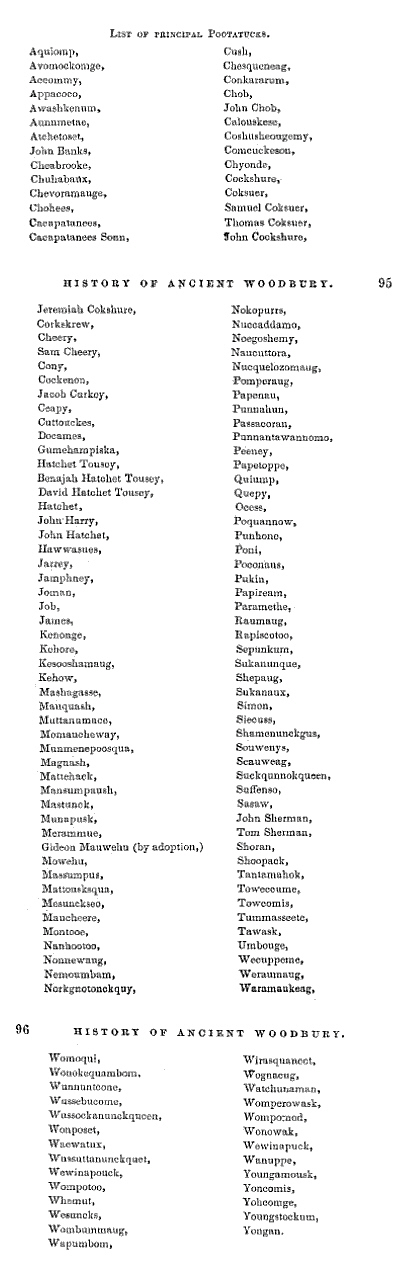
Without a doubt, one of the most often used local Algonquian place-names used every day in Woodbury, Connecticut is the word “Nonnewaug.” Among other things it is a river, a high school and a school district, a road, and more. A section of the town is still called “Minortown,” but it was originally called “Lower Nonnewaug.” The region that includes the Upper and Lower Nonnewaug was originally called “The Nonnewaug Purchase” in 1700 when the “fourth purchase of land was made from the tribe of Indians called Nonnewaug (“Woodbury and the Colonial Homes.” page 18). William Cothren, describing the layout of Main Street in his 1854 History of Ancient Woodbury, refers to “…the Indian trail leading from the Nonnewaug wigwams to Pootatuck village, passing the grave of Pomperaug…(page 38).”
Despite references to the area of land, the Indian place-name’s origin is popularly known as a reference to a Native American person who lived in the years around 1700 who is mentioned in early Woodbury land deeds and was identified on them as “Nunawauk,” “Nunnawake,” and “Nunnawaoke,” accompanied by “his marke,” that Cothren believes to be a snowshoe, but also bears resemblance to an eel trap. By the 1850’s the person referred to became known as the Sachem Nonnewaug.

The word "Sachem" is traced by linguists to the Proto-Algonquian word for leader, "sa:kima:wa" and "all it’s variations are of a linguistic nature, rather than functional (Bragdon 1996)." Robert Grumet uses the word "sakima" in The Lenapes (1988), and translates it to: "Keeper of the Peace" or "Peace Chief." The man known as the Sachem Nonnewaug on those ancient deeds was most likely chosen as "Peace Keeper" by the people who settled with him at a place that was known by them as Nonnewaug, a contraction of a descriptive string of Algonquian words, and not the man’s name at all, but rather his title, sort of like calling someone by the name of the city or the country (
the place) where that person was the Mayor or the President.
William Cronan, writing in his 1983 Changes in the Land, says that Indian place-names in New England “related not to possession but to use (page 65).” The Woodbury historian William Cothren had much the same to say in 1872 in his second volume of his History, “Every name described the locality to which it was affixed…sometimes it indicates one of the natural products of the place, or of the animals which resorted to it…a definite meaning, such as seemed called for by the object named, or the circumstances surrounding it…” Cothren goes on to say, “PAUG, POG, BOG, donates water at rest. But in New England in some instances, it is applied to brooks, rivers, and running streams. AMAUG, denotes a fishing place…From these particles, and others, out of which the local names of our territory were constructed, as well as from local tradition, we may, perhaps, translate our Indian appellations as follows: (which eventually includes)… NONNEWAUG, the fresh pond or fresh fishing place …”
A native Connecticut writer with a PhD in linguistics, Carl Masthay writes in New England Indian Place Names, “One salient ending is -peaq or – paug, meaning ‘watery (p) open area (-aug)…Another salient ending is –tuck, “river (with waves), not to be confused with –uck, ‘land’ or -tuck, ‘tree…Thus we have…Nonotuck (MA), ‘in the middle of the river…’ If Nonne is the same as or similar to Nono -and as Cothren says, “AMAUG, denotes a fishing place” could it mean – and describe-“The Fishing Place (or Weir) in the Middle of the Open Area?”

The weir is located on the river at the edge of a floodplain, near what may be the site of the “Nonnewaug wigwams” Cothren refers to, as well as the associated burial grounds that he describes in his History. The descriptive place name, applied to the location of the stone Weir, as well as local history, seem to point out a Native American construction, a fishing place in the middle of an open or cleared area. Cothren writes that “Our fathers… quickly placed the open lands under cultivation, securing good crops the year of their removal… and they quickly overrun all meadow land quite to Nonnewaug Falls.” The early English settlers from Stratford were able to plant because the Native People had already cleared the land. Native People still lived at the floodplain by the Falls, by the weir until the “confirmatory deed of 1706,” possibly to 1734 when the land was divided into “homelotts,” as documented in Cothren’s History.
In The Fair Lawn/Paterson Fish Weir from the Bulletin of the Archaeological Society of New Jersey, Vol. 54, 1999, allen lutins and Anthony P. DeCondo write:
“Riverine fish weirs in eastern North America are generally associated with the exploitation of anadromous and catadromous fish. Anadromous fish are those which migrate upstream from the sea to spawn, and catadromous fish (primarily eels) are those which swim from lakes, rivers and streams out to sea to spawn. Fisher (1983:36) characterizes anadromous fish as constituting "probably the greatest density of available food that existed for pre-agricultural societies in the Hudson Valley." They are a particularly attractive resource because spawning runs occur within a highly predictable time frame. These runs can usually be predicted to within a few days' accuracy (
http://www.lutins.org/weir/index.html).”
See also:
Prehistoric Fishweirs in Eastern North America - Master's Thesis by allen lutins
http://www.lutins.org/thesis/
Weirs have been documented on the Housatonic River that the Nonnewaug River eventually flows into. In 1947, Claude C. Coffin wrote about stake weirs that were found at the mouth of the river as well as stone weirs farther inland. He writes:
"(The) mode of construction changed beyond the mouth of the river. At the mouth of the river, the Indians drove the stakes into clay or shell bottom, which held them firmly in place. But up the river, where the current was much stronger and swifter, and the bottom was loose with sand and rocks, the stakes would not stand up for long, for the current washed them out. To overcome this difficulty, the Indians built stone walls out from shore, extending down into the river for almost thirty to forty feet. The walls were built at an angle of about seventy five degrees and heading upstream (Figure 10). Some of the stones were quite large, and it would require two men to handle them. After these walls were built, the stakes were driven between the rocks and in that way the river could not undermine them. At this late date, the stakes have all disappeared. However the walls are still there and can be found at very low tide or when the river is very low in the summer month. I have found two such walls, one at Wheeler’s Farms, in the northwestern part of Milford township, another across the river in Shelton Township, north of the mouth of the Far Mill River. I found still another at Otter Rock in Oxford township below the Stevenson power dam. A friend, Mr. Clyde Batchelor, has informed me that he has seen several walls at Still River in New Milford. That was a famous ground for fishing shad in the early days. There is no doubt that, in the early times, these fish weirs were numerous for miles along the river, as far as the shad and other fish went to their spawning grounds. But today they have all about disappeared. Some of course are buried under mud and sand; others have been destroyed by dredging; while others are under flooded areas where power dams have been installed. Extinct also are the fish that once went up the river by the tens of thousands."

Conclusion
The Algonquian place name, it’s proximity to a historically documented village, the Nonnewaug wigwams, and the great distance between it and the earliest mill suggests that the row of boulders is possibly a native-built construction similar to others across the nation. Some of these stone weirs have been added to the National Historic Register, such as the Indian Fish Weir (Also known as Indian Dam, Indian Fish Trap or Site #13IW100) in Iowa. Natural processes are eroding the weir; few weirs have been studied despite their widespread use. A study of the Nonnewaug Weir could add much understanding to the archaeological record.
References Cited
Bragdon, Kathleen J.
1999 “Native People of Southern New England.” University of Oklahoma Press
Coffin, Claude C.
1947 “Ancient Fish Weirs Along the Housatonic.” Bulletin 21 of the Archeological Society of Connecticut
Cothren, William
1854 “History of Ancient Woodbury Volume I.” Waterbury CT
1872 “History of Ancient Woodbury Volume II.” Woodbury CT
Cronan, William
1983 “Changes in the Land; Indians, Colonists, and the Ecology of New England”
N.Y.: Hill and Wang.
Lutins, Allen and Anthony P. DeCondo
Jan. 25, 2005 The Fair Lawn/Paterson Fish Weir.
http://www.lutins.org/weir/index.html
Masthay, Carl
1987 New England Indian Place Names in Rooted like the Ash Trees Richard C.
Carlson, ed. 13-17 Naugatuck CT : Eagle Wing Press.
Strong, Julia Minor, ed.
1931 "Woodbury and the Colonial Homes." Woodbury, Conn.: Woodbury
Woman's Club.